|
Click here for more information
Present (and Past) GML Research Students and Associates
- Connor Nickel (Honours, 2019-2020), Project: "An Analysis of Elk (Cervus elaphus Railway Usage Following Highway Wildlife Mitigation Near Burwash Ontario"
- Nick Saucier (Honours, 2019-2020), Project: "GIS-Based Accumulation Model of Microplastics in the Saint John River Watershed"
- Morgan Bender (Research Assistant, 2019), Project: "Mount Allison University Seabird Viewer"
- Laura Penney (Honours, 2018-2019), Project: "Using Machine Learning to Assess Interactions Between Forage Fisheries and Upper Trophic-level Marine Species: A Case Example with Northern Gannet"
- Anna Jamieson (Honours, 2017-2018), Project: "Assessing Awareness of Ticks and Lyme Disease and the Impact of Geospatial Visualization on Public Perception of Risk"
- Jessie McIntyre (Honours, 2017-2018), Project: "Whimbrel (Numenius phaeopus) Stopover on the Acadian Peninsula, NB: An Application of Habitat Classification using Remote Sensing"
- Leah Rudderham (2017), Project: "Land Use and Water Quality in the Northumberland Strait"
- Jacob Demers (2017), Project: "Human Land Use along the Richibucto River: a Spatial Analysis of Distribution and Significance"
- Laura Penney (2017), Project: "Effective Communication of Flood Risk using the Tools of Geovisualizations: a Case Study from Dorchester, NB"
- Caitlin Brawn (Honours, 2016-2017), Project: "Modelling Fishing Vessels Traffic in Atlantic Canada Using Machine Learning Regression Tree Modelling"
- Jeremy Dussault (Honours, 2016-2016), Project: "GIS Assessment of the Risks Posed by Coastal Light Pollution for Seabirds Nesting in Atlantic Canada"
- Cullen Mulroy (Honours, 2015-2016), Project: "Assessing the Coastal Flood Risk for the Community of Port Elgin, New Brunswick"
- Megan MacIntosh (M.Sc., 2015), Project: "The Effect of Landuse on Waterfowl Habitat Quality in an Agricultural Region of Atlantic Canada"
- Matthew Mahoney (M.Sc., 2015), Project: "Assessing Short Term Coastal Dynamics to Predict Impacts from Severe Weather Events on Piping Plover"
- Laura Salisbury (Honours, 2011-2012), Project: Flood-risk Visualization
- Keegan Smith (Honours, 2011-2012), Project: Applications of Lidar to Forest Classification
- Man-Sing Kwan (2010), Project: Maritime Wind Atlas
- Neil Gouder (2010), Project: Maritime Wind Atlas
- Lindsay Laltoo (2010), Project: Black Duck Habitat Use and Visualization
- Alicia Daniel (2010), Project: Town of Sackville Policing Survey
- Courtney Morrison (2009-2010), Project: Fundy Biosphere Reserve Mapping
- Jeffrey Thomas (2009), Project: Black Duck Habitat Use and Visualization
- Alex Miller (2008, Science Horizons Student Intern), Project: Aerial Surveillance of Marine Oil Pollution
- Mr. James Bornemann (GIS/Geomatics Analyst, Researcher)
- Ms. Lori-Ann Roness (Researcher)
- Mr. Jeffrey Wilson (Vice-President Green Analytics, http://www.greenanalytics.ca)
- Emily Phillips (Mt. Allison M.Sc., Researcher)
Home
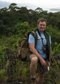
 David J. Lieske is an Associate Professor in the Department of Geography
and Environment, and is the Director of the Mount Allison University
Geospatial Modelling Lab (GML).