|
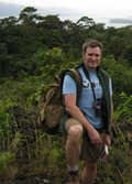 David J. Lieske is an Associate Professor in the Department of Geography
and Environment, and is the Director of the Mount Allison University
Geospatial Modelling Lab (GML).
David J. Lieske is an Associate Professor in the Department of Geography
and Environment, and is the Director of the Mount Allison University
Geospatial Modelling Lab (GML).
An Honours Thesis is an excellent opportunity to explore a research topic in depth, to make a contribution to human knowledge, and to really hone your verbal and written communication skills.
Completing an honour's thesis prepares you for anything, whether it be graduate school; designing a research study, gathering information, and conducting an analysis; or speaking on a stage or in a boardroom. It will make you a better thinker, and a better communicator.
An Honours thesis is a significant commitment, however - both for you, the student, as well as your faculty supervisor. To pursue an Honours project in the GML you need to be able to fulfill the following criteria:
- A term/session (e.g., year #3) GPA of 3.2 or higher.
- Interest in and good performance (B+) in the department's GIS course
(GENS 2441).
- Interest in completing a project with a significant spatial focus,
including, but not limited to:
- Species distribution modelling, i.e., modelling the relationships between the geographical occurrence of a species, and the key environmental factors to which it responds (e.g., habitat, climate).
- Land cover classification, land cover analysis.
- Spatial statistics, e.g., hotspot analysis, spatial predictive modelling
- Development of special visualizations for exploring relationships in time and space.
- Assessing how people perceive and interpret spatial information.
- Geocomputing, e.g., web mapping or custom development of a geoprocessing tool.
- Risk mapping, e.g., pollution risk.
Home