|
 ** Downloads:
Welcome!
Welcome to the Tantramar Community Adaptation Viewer Project page, summarizing work conducted by the Geospatial Modelling Lab (GML) of Mount Allison University, supported by the New Brunswick Environmental Trust Fund and SSHRC Grant to Small Universities fund.
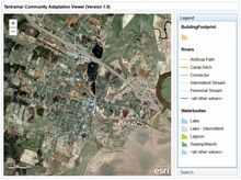
What is the 'Community Adaptation Viewer (CAV)'?
Climate change poses significant challenges to Canadian communities. Based on research funded by the Atlantic Climate Adaptation Solutions Association ( http://atlanticadaptation.ca), the Tantramar area of south-eastern New Brunswick is threatened by significant sea-level rise over the next century.
Adapting to these risks constitutes a major challenge, and requires a concerted effort by the entire community. But the question remains: what can we do to lower our vulnerability?
|
Project Partners